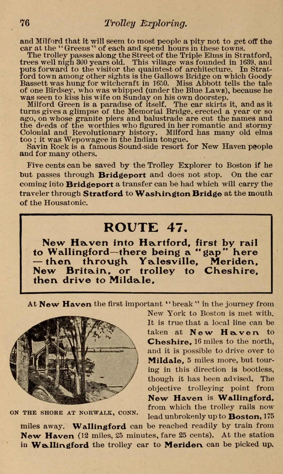
The next guide page explains that onward travel from New Haven required rail to Wallingford or a trolley to Cheshire followed by a drive to Milldale.
Evidence, credit & reuse: Public domain in the United States: book published in Brooklyn in 1904; faithful scan. Route 47 is the guide’s itinerary number. The small illustration is labeled Norwalk, not New Haven. Historic anecdotes in unrelated paragraphs have not been independently verified and should not be recycled as factual captions. Resized and WebP compressed only; no historical content added, retouched or removed.
Source: Cromwell Childe, author; Brooklyn Daily Eagle, publisher; Columbia University Libraries; Internet Archive; The Durst Organization
Searchable text & research notes
Included OCR or searchable notes appear below and in the download. Use your browser’s Find command to search this page. OCR errors and historical language are retained.
Read the included text
The next guide page explains that onward travel from New Haven required rail to Wallingford or a trolley to Cheshire followed by a drive to Milldale. The route guide prevents a misleading reading of a dense network map: a traveler still encountered gaps and changes of transport.
Cite this item
Silent Grounds Collective, New Haven & West Haven Trolleys, SGC-TR-019, TR-012, “Printed route guide: the gap north of New Haven, 1904.” Source: Cromwell Childe, author; Brooklyn Daily Eagle, publisher; Columbia University Libraries; Internet Archive; The Durst Organization. https://archive.org/details/trolleyexploring00chil/page/76/mode/1up. Research edition, accessed 2026-09-08.