
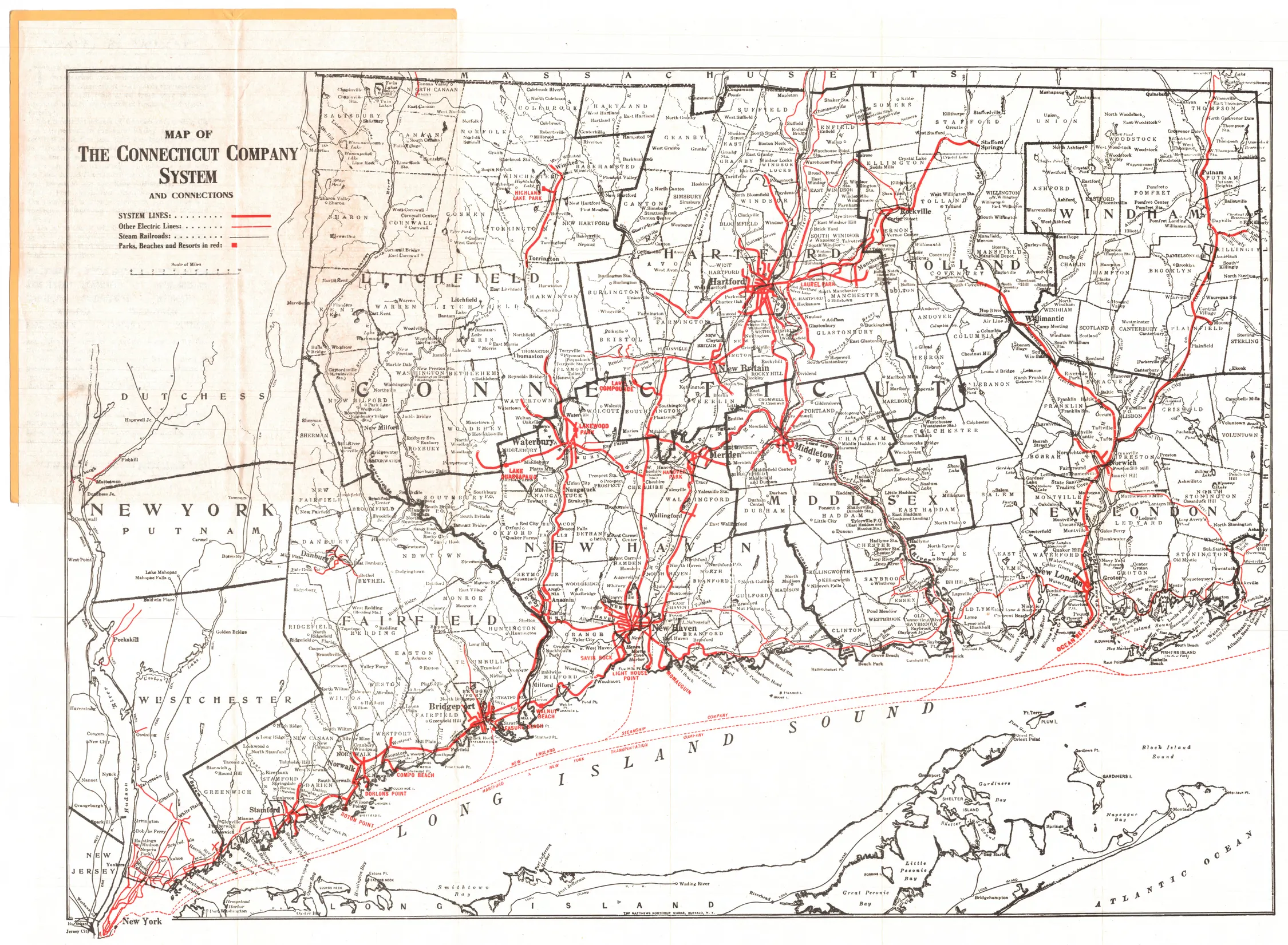
The Connecticut Company’s 1920 map places New Haven and the coast within a dense statewide transport network.
Evidence, credit & reuse: Public domain in the United States; Commons PD-US-expired / PD-scan. Commons catalog warns that Shore Line Electric Railway service was suspended from 1919 to 1923 despite its depiction here. Treat the scan as a published network depiction, not an audited operating schedule. Resized and WebP compressed only; no historical content added, retouched or removed.
Source: The Matthews Northrup Works, Buffalo, New York; Connecticut Historical Society (now Connecticut Museum of Culture and History), object 16372; Wikimedia Commons
Searchable text & research notes
Included OCR or searchable notes appear below and in the download. Use your browser’s Find command to search this page. OCR errors and historical language are retained.
Read the included text
The Connecticut Company’s 1920 map places New Haven and the coast within a dense statewide transport network. The title explicitly includes connections. A line appearing here should not automatically be captioned as a Connecticut Company route or as operating throughout 1920.
Cite this item
Silent Grounds Collective, New Haven & West Haven Trolleys, SGC-TR-019, TR-005, “Connecticut Company system and connections, 1920.” Source: The Matthews Northrup Works, Buffalo, New York; Connecticut Historical Society (now Connecticut Museum of Culture and History), object 16372; Wikimedia Commons. https://commons.wikimedia.org/wiki/File:1920_Map_of_the_Connecticut_Company_System_and_Connections.jpg. Research edition, accessed 2026-09-08.