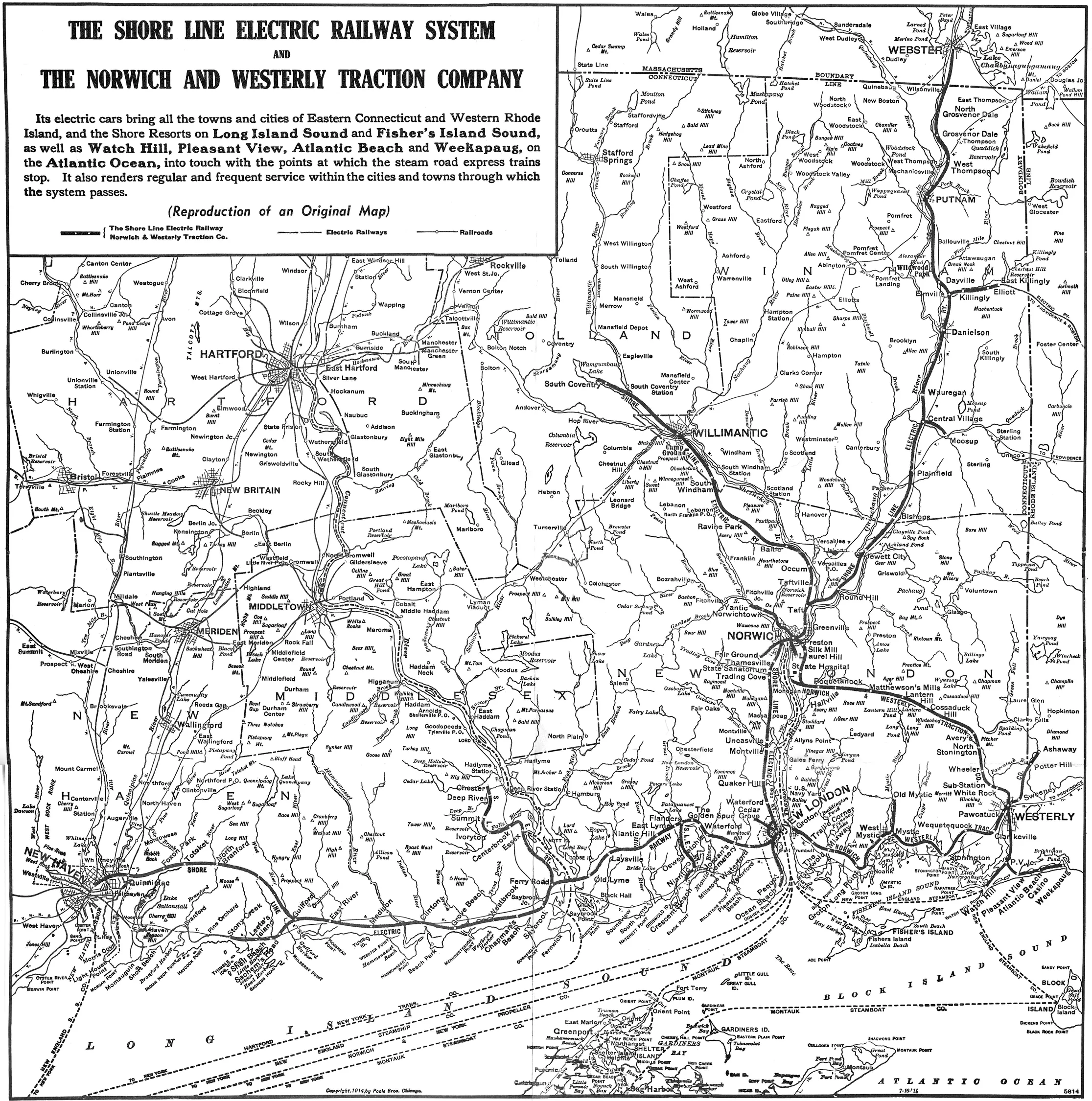
The Shore Line Electric Railway and Norwich and Westerly Traction Company mapped their eastern Connecticut network in July 1914.
Evidence, credit & reuse: Public domain in the United States; Commons PD-US-expired / PD-scan. Scanned from a copy of the original map republished in The Shore Line Electric Company: Development of the System, Connecticut Valley Chapter NRHS, Transportation 13(1), October 1960. Original map date and later reproduction date are distinct. Resized and WebP compressed only; no historical content added, retouched or removed.
Source: Shore Line Electric Railway; Original company map; NRHS reproduction; Wikimedia Commons
Searchable text & research notes
Included OCR or searchable notes appear below and in the download. Use your browser’s Find command to search this page. OCR errors and historical language are retained.
Read the included text
The Shore Line Electric Railway and Norwich and Westerly Traction Company mapped their eastern Connecticut network in July 1914. This corporate map is evidence of the historic Shore Line Electric Railway. That company and today’s Shore Line Trolley Museum are different entities.
Cite this item
Silent Grounds Collective, New Haven & West Haven Trolleys, SGC-TR-019, TR-004, “Shore Line Electric Railway system, July 1914.” Source: Shore Line Electric Railway; Original company map; NRHS reproduction; Wikimedia Commons. https://commons.wikimedia.org/wiki/File:1914_Shore_Line_Electric_Railway_system_map.jpg. Research edition, accessed 2026-09-08.