
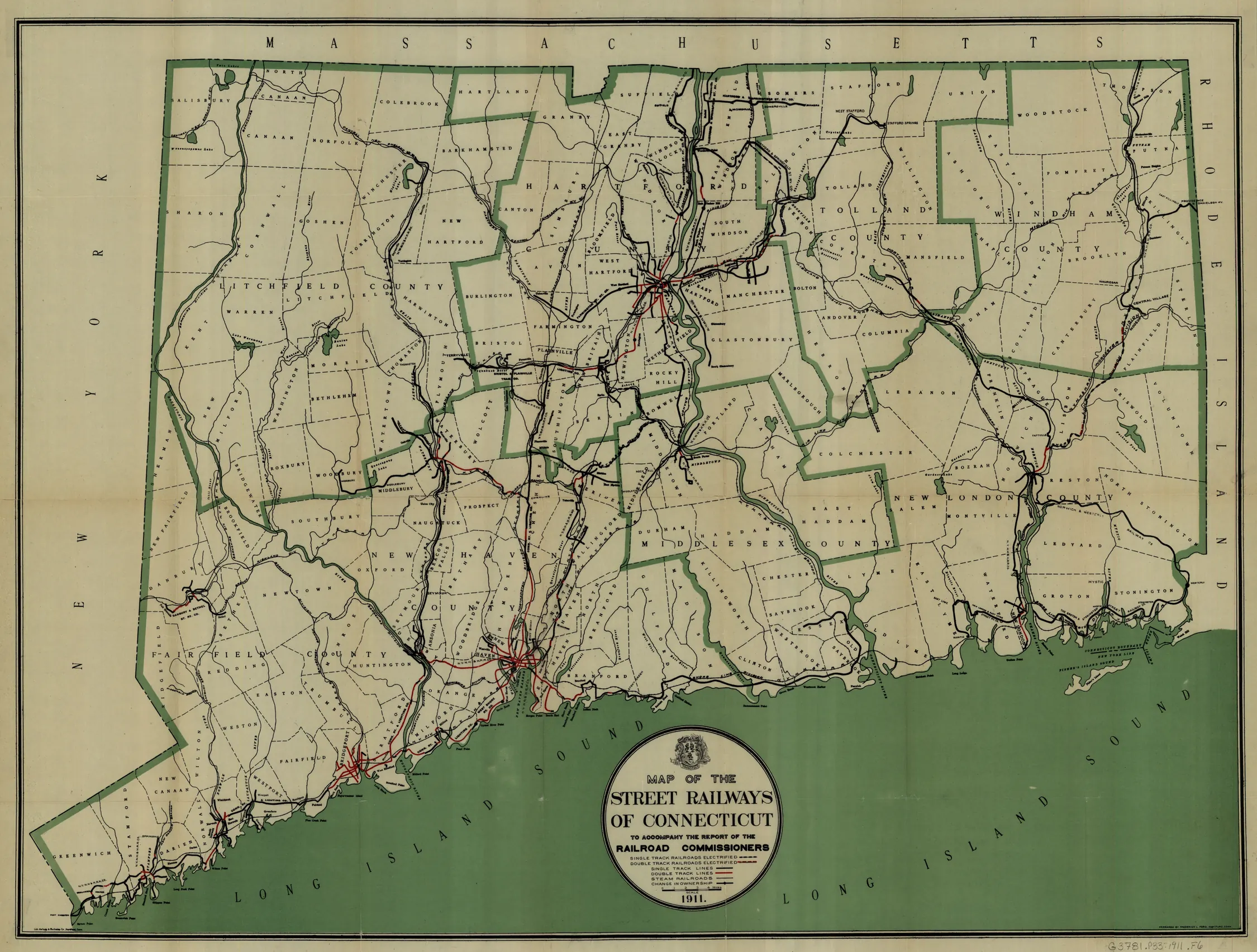
A statewide 1911 railway map shows the New Haven network in relation to Connecticut’s other systems.
Evidence, credit & reuse: Public domain in the United States; Commons PD-US-expired / PD-scan. Published to accompany the Railroad Commissioners’ report. Map lines are not all streetcar routes; use the original legend. Full resolution source retained for fine labels. Resized and WebP compressed only; no historical content added, retouched or removed.
Source: Frederick L. Ford (Commons catalog attribution); University of Connecticut Libraries, via Wikimedia Commons
Searchable text & research notes
Included OCR or searchable notes appear below and in the download. Use your browser’s Find command to search this page. OCR errors and historical language are retained.
Read the included text
A statewide 1911 railway map shows the New Haven network in relation to Connecticut’s other systems. The printed legend distinguishes street railway tracks, electrified railroads and steam railroads. Preserve those distinctions when tracing a journey.
Cite this item
Silent Grounds Collective, New Haven & West Haven Trolleys, SGC-TR-019, TR-003, “Map of the street railways of Connecticut, 1911.” Source: Frederick L. Ford (Commons catalog attribution); University of Connecticut Libraries, via Wikimedia Commons. https://commons.wikimedia.org/wiki/File:1911_Connecticut_street_railway_map.jpg. Research edition, accessed 2026-09-08.