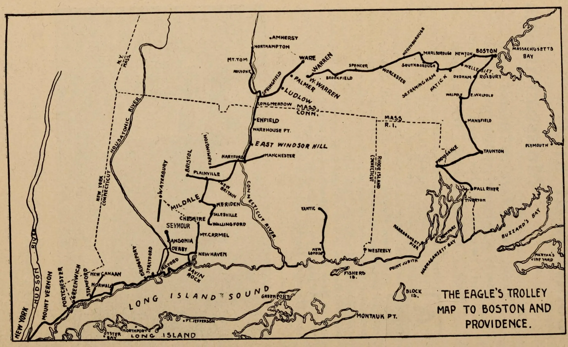
The 1904 guide’s map places Savin Rock and New Haven within a wider network of trolley excursions.
Evidence, credit & reuse: Public domain in the United States: book published in Brooklyn in 1904; faithful scan. Optimized image crops the printed map from page 68 and rotates it 90 degrees clockwise so its title and map labels are upright. Original whole-page download is preserved. Map is schematic and includes waterways and other contextual lines. Printed map extracted from page 68, excluding running book title and page number, then rotated 90 degrees clockwise; map content unaltered.
Source: Cromwell Childe, author; Brooklyn Daily Eagle, publisher; map artist not separately identified; Columbia University Libraries; digitized by Internet Archive with support from The Durst Organization
Searchable text & research notes
Included OCR or searchable notes appear below and in the download. Use your browser’s Find command to search this page. OCR errors and historical language are retained.
Read the included text
The 1904 guide’s map places Savin Rock and New Haven within a wider network of trolley excursions. The accompanying guide describes a break north of New Haven. Read its map and instructions together; the drawing is not evidence of one continuous through-running streetcar.
Cite this item
Silent Grounds Collective, New Haven & West Haven Trolleys, SGC-TR-019, TR-002, “The Eagle’s trolley map to Boston and Providence.” Source: Cromwell Childe, author; Brooklyn Daily Eagle, publisher; map artist not separately identified; Columbia University Libraries; digitized by Internet Archive with support from The Durst Organization. https://archive.org/details/trolleyexploring00chil/page/68/mode/1up. Research edition, accessed 2026-09-08.